This note continues the earlier Hokuriku prehistory and Asuka-period notes. This time we move forward to the Nara period (710–794), again focusing on Kanazawa, Toyama, and Komatsu, the areas this trip will pass through. The Heian period and later will be a separate note.
In the Nara period the three areas were not administrative equals. Toyama belonged to Etchū Province, by then a fully established ritsuryō province with a provincial capital and governors, one of whom — Ōtomo no Yakamochi — had his five years there preserved in the Man’yōshū. Kanazawa and Komatsu, in the southern part of today’s Ishikawa Prefecture, were still inside the large framework of Echizen Province; Kaga Province was not established until 8231. The amount and the form of what each area left behind differ greatly, and the main reason lies in this difference of institutional position. This note organizes what each area left and where those materials correspond to places on the ground.
1. What Was the Nara Period?
The Nara period conventionally runs from 710, when Empress Genmei moved the capital from Fujiwara-kyō to Heijō-kyō, to the move to Heian-kyō in 794 (strictly speaking, the capital left Nara for Nagaoka-kyō in 784). The Heijō Palace Site Historical Park explains that Heijō-kyō was built by Empress Genmei as the center of government under the ritsuryō legal system: a rectangle roughly 4.3 km east–west and 4.8 km north–south, with the Suzaku Avenue about 74 m wide and an estimated population of over one hundred thousand2.
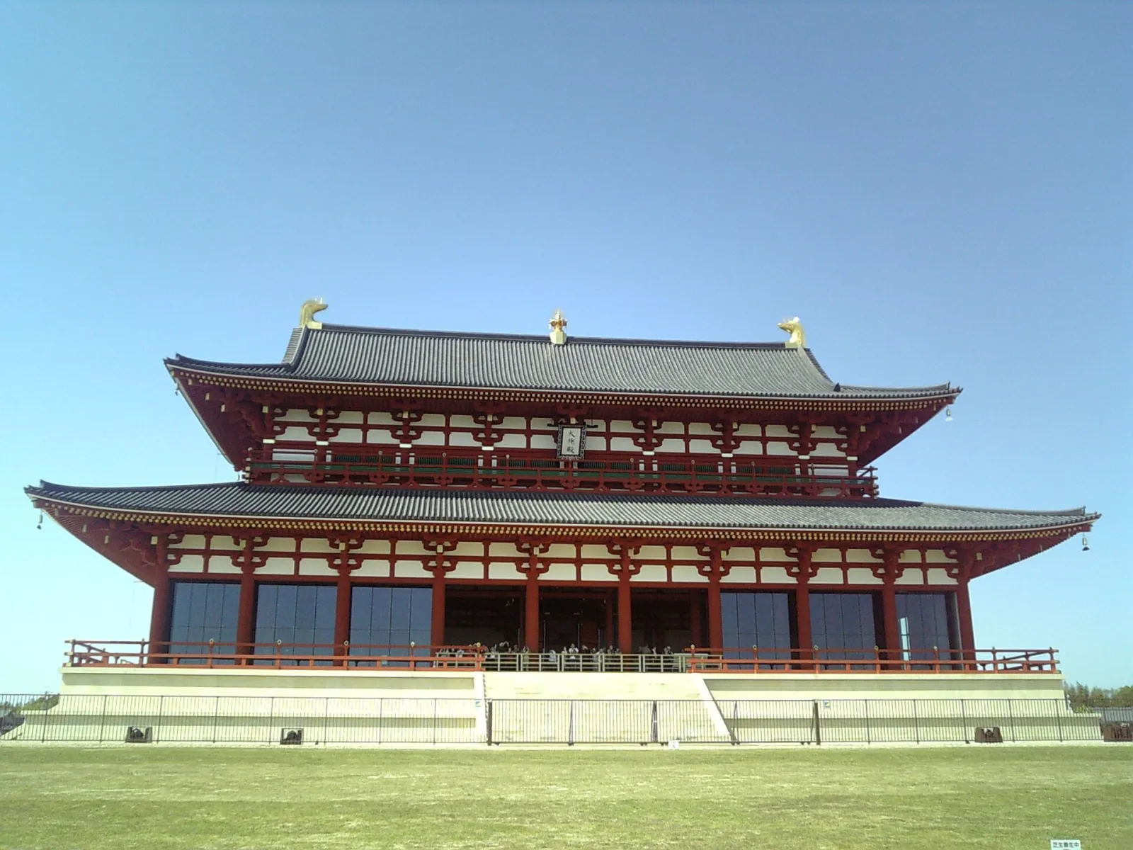
The reconstructed First Daigokuden (Great Audience Hall) at the Heijō Palace Site, the stage for imperial accessions and other major ceremonies2. Source: Wikimedia Commons
The Nara-period background relevant to Hokuriku can be seen on at least three levels.
First, the working of the ritsuryō system. After the Taihō Code of 701 created the province–district–village structure, the court systematically appointed governors, collected taxes, and compiled registers. The Shoku Nihongi, the official history covering the Nara period, is full of entries about disasters, taxes, shrines, and personnel in each province — and it is this system that determined how visible the three Hokuriku areas were in central records3.
Second, state Buddhism. In 741 Emperor Shōmu ordered every province to build a provincial temple (kokubunji) and nunnery, with Tōdai-ji in Yamato as their head temple; the Great Buddha was dedicated in 752. This program replicated the Buddhist state province by province, and the Etchū Kokubunji is its landing point in Hokuriku4.
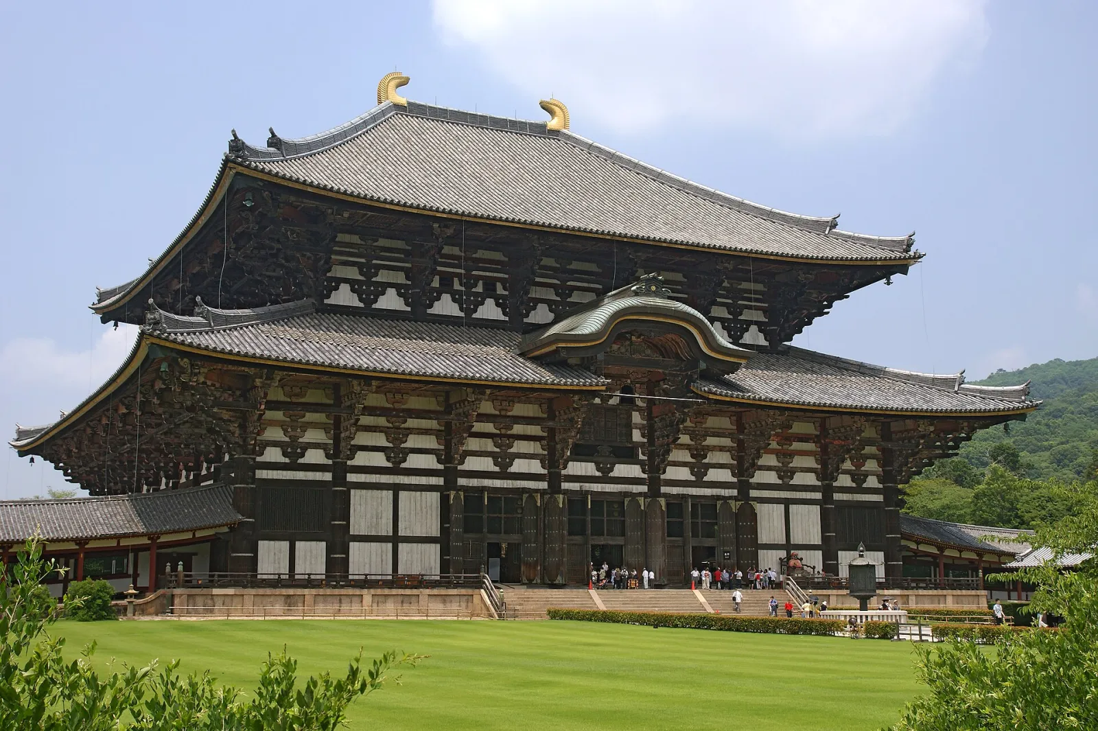
The Great Buddha Hall of Tōdai-ji. The temple’s estate management reached into Etchū and Echizen, and it will come up repeatedly in the sections below. Source: Wikimedia Commons
Third, mass production of writing. The Kojiki (712) and Nihon Shoki (720) were completed, much of the Man’yōshū was composed in this era, and the provinces produced wooden tablets, ink-inscribed pottery, and estate documents. Thanks to the Shōsō-in repository, we can still look at Nara-period maps of Tōdai-ji’s estates in Etchū today5.
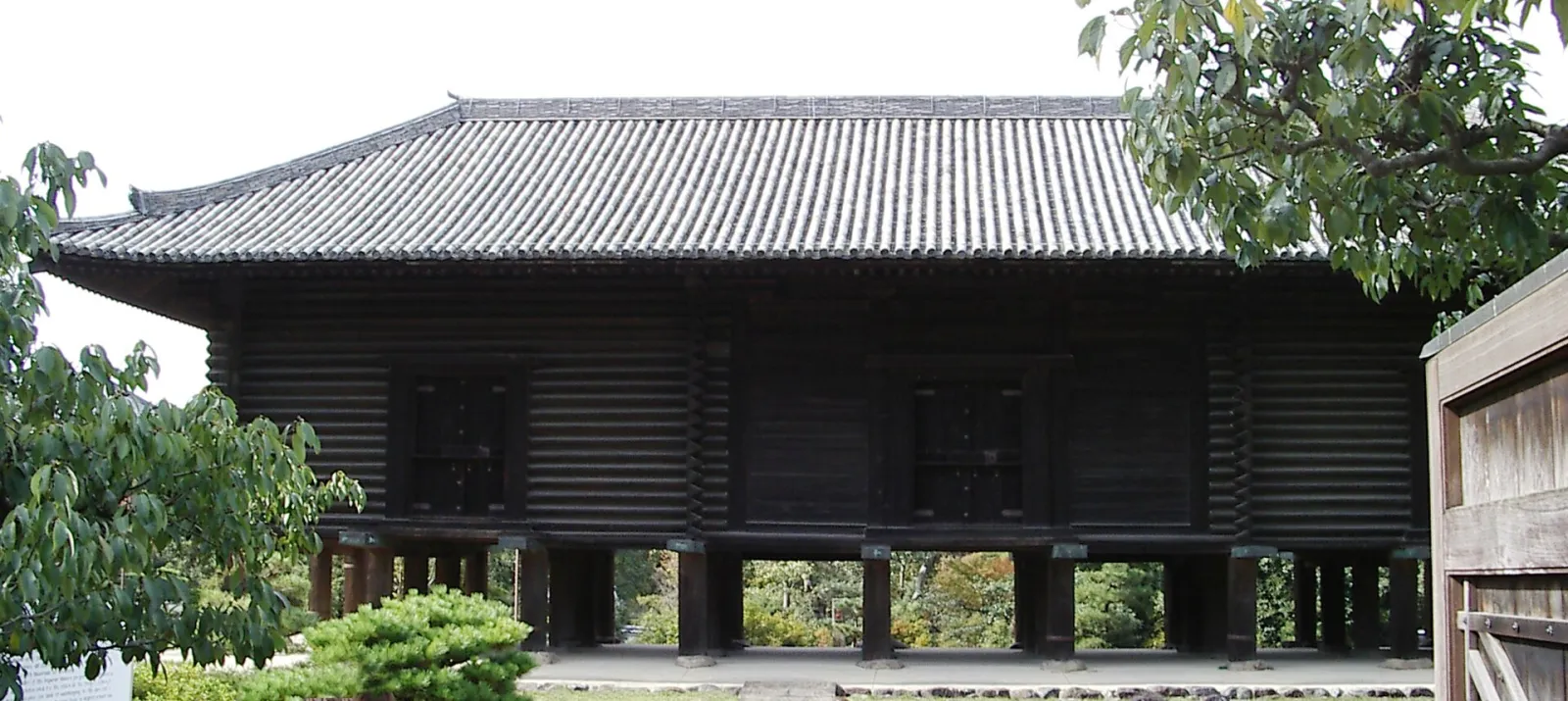
The Shōsō-in. The Nara-period maps of estate development in Etchū Province survive to this day through this repository5. Source: Wikimedia Commons
2. The Administrative Frame: “Kaga” Did Not Exist Yet
The first thing to avoid when writing about Nara-period Hokuriku is anachronism. The broad Japan Sea region called “Koshi” was divided under the ritsuryō system into Echizen, Etchū, Echigo, and other provinces. The Shoku Nihongi preserves traces of this process:
- An entry of 701 lists seventeen provinces hit by locusts, already including “Echizen”; an entry of 702 records an epidemic in Echigo3.
- A 702 entry records that “four districts of Etchū Province were transferred to Echigo Province” — Etchū not only existed by then, its borders were still being adjusted3.
- In 706, nineteen shrines in Kai, Shinano, Etchū, Tajima, Tosa, and other provinces were added to the annual prayer offerings6.
- When inspectors (azechi) were installed in 719, “the governor of Echizen … supervised the three provinces of Noto, Etchū, and Echigo” — Echizen, Noto, Etchū, and Echigo appear as parallel province names7.
Ishikawa Prefecture’s historical outline states that Noto Province split from Echizen in 718, and Kaga Province was only established in 8238. The city of Komatsu’s “1200 Years of Kaga Province” page is more specific: after the Taihō Code, Echizen was a huge province about 240 km long that included all of today’s Ishikawa Prefecture; when Kaga split off in 823, the two districts of Kaga and Enuma were reorganized into four by creating Ishikawa and Nomi districts1.
One more episode matters for Toyama: Noto Province was merged into Etchū in 741 and did not regain independence until 7579. This is the institutional background that let Ōtomo no Yakamochi tour Noto during his term as governor of Etchū and leave poems about it.
To sum up: Nara-period Toyama belonged to Etchū Province, with the capital around Fushiki in today’s Takaoka; Kanazawa and Komatsu belonged to the Kaga and Enuma districts in northeastern Echizen, with no provincial capital of their own and no appearances in the records under the name “Kaga Province” yet.
3. Toyama and Takaoka: The Etchū Capital and Ōtomo no Yakamochi
The densest cluster of Nara-period writing in Hokuriku sits around the Etchū provincial capital — the Fushiki area of today’s Takaoka. The place name of Shōkō-ji temple, “Fushiki-Kokufu” (literally “old provincial capital”), preserves that memory, and a stone monument reading “Site of the Etchū Provincial Office” stands in the temple grounds, the presumed location of the capital. The exact position of the government buildings has not yet been confirmed archaeologically10.
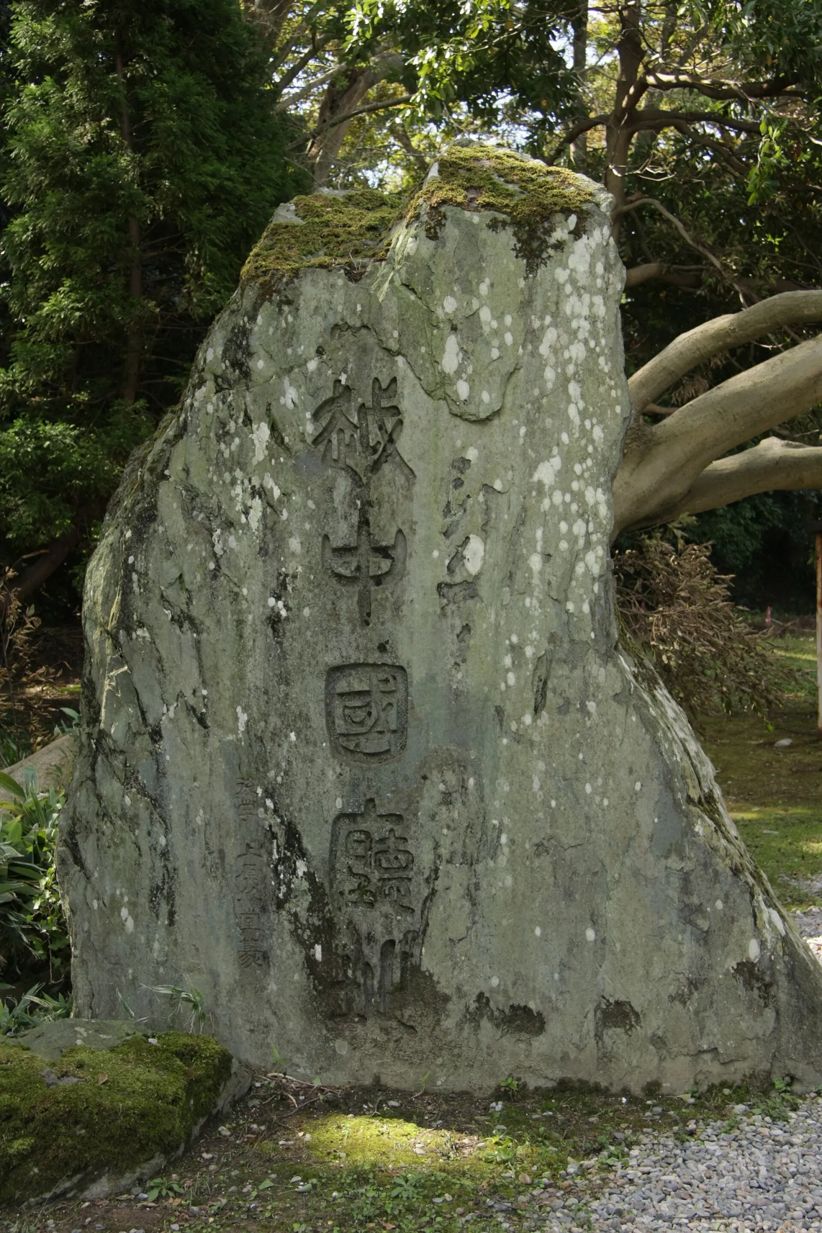
The “Site of the Etchū Provincial Office” monument in the grounds of Shōkō-ji. The location is presumed; the monument itself is a later erection. Source: Wikimedia Commons
What links the Etchū capital to the written record of the Nara period is, above all, Ōtomo no Yakamochi. According to the Takaoka Man’yō Historical Museum, Yakamochi was appointed governor of Etchū in the sixth month of 746, took up his post in the eighth month, and returned to the capital in the seventh month of 751 — about five years in Etchū11.
The museum quantifies this period: of Yakamochi’s documented poetic career, the five Etchū years alone account for 223 poems; the “Etchū Man’yō” poems total 330, including 4 poems about Etchū Province and 3 about Noto Province — the essential corpus for understanding ancient Etchū11. A court aristocrat-poet served here for five years and his work was preserved wholesale in the Man’yōshū; neither Kanazawa nor Komatsu has anything comparable.
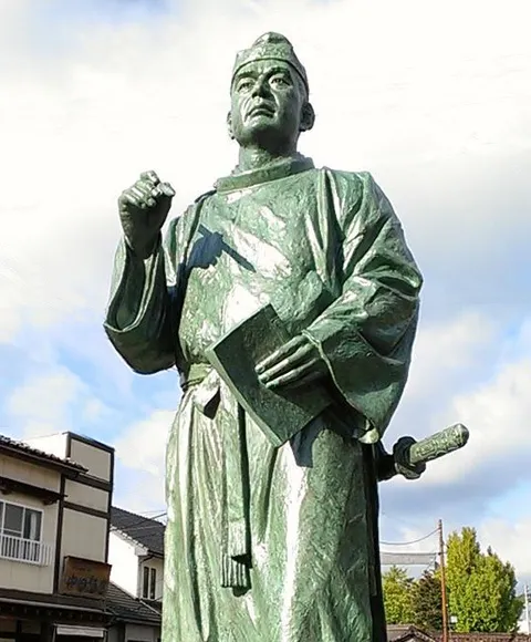
Portrait of Ōtomo no Yakamochi. Source: Takaoka Man’yō Historical Museum
The sea, harbors, and Mount Tate of Yakamochi’s poems are easiest to experience today at the Amaharashi coast. On a clear day the Tateyama range is visible across Toyama Bay — the signature landscape of the Etchū Man’yō11.
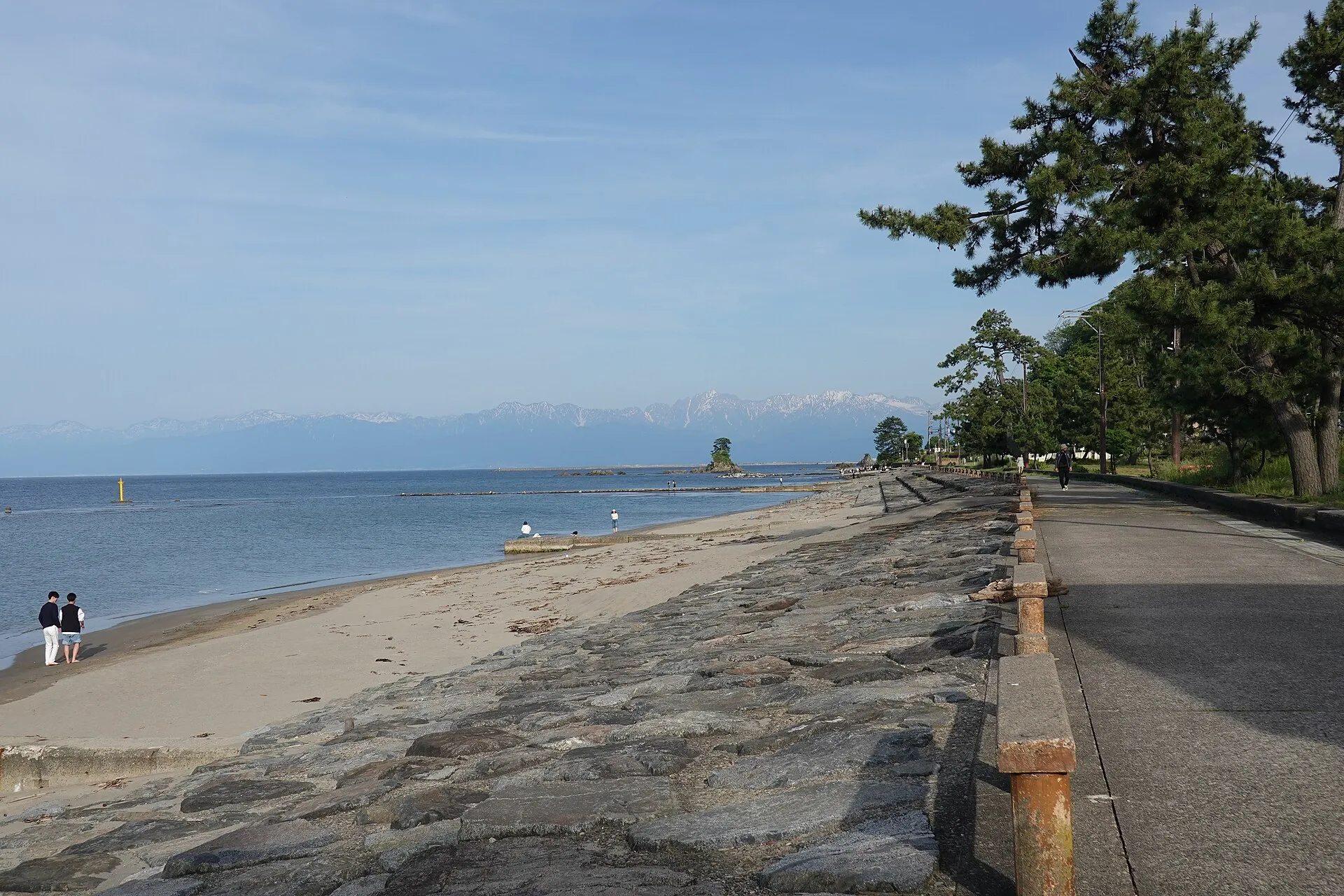
The Amaharashi coast. The small island offshore at left is Onna-iwa; the snow-streaked Tateyama range rises in the distance. Source: Wikimedia Commons
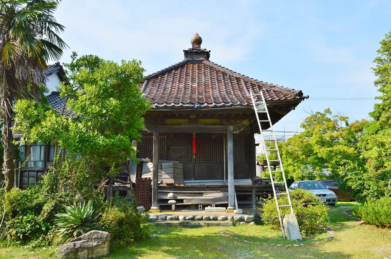
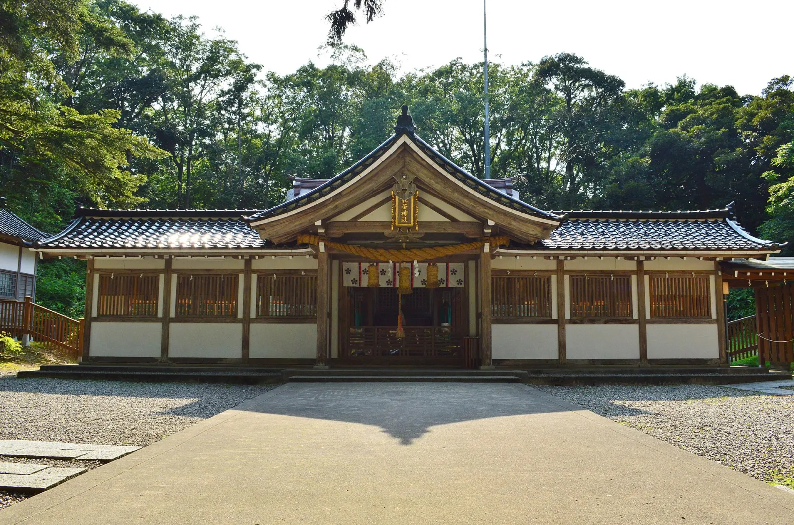
Two institutional points sit beside the presumed capital. One is the Etchū Kokubunji site: the provincial temple established after the 741 edict, in Fushiki-Ichinomiya, Takaoka; excavations in 1936 recovered eave tiles, flat and round tiles, and inkstones of the late Nara Heijō-kyō style. Today it is the precinct of the Yakushi-dō hall, a Toyama Prefecture designated historic site12. The other is Keta Jinja: by tradition founded in the Nara period and later counted as a first shrine (ichinomiya) of Etchū, standing right in the presumed capital area. The founding date is shrine tradition, not a contemporary source, but the spatial relationship — a ritual center next to the administrative center — is intuitive when you walk the site13.
4. The Tōdai-ji Estate Maps and Estate Development in Etchū
Nara-period Toyama has one more concrete set of documents: the Tōdai-ji kaiden-zu (estate development maps). The Agency for Cultural Affairs describes them as Nara-period maps of the development of Tōdai-ji’s estates in Echizen and Etchū: a grid of jōri land-division lines fills the center of each sheet, each square inked with plot number, land type, and cultivated area, and the boundary between Tōdai-ji land and other land drawn in red — a precious window onto conditions in the provinces during the Nara period5.
The surviving maps name specific villages in Etchū: Ishiawa in Tonami district, and Naruto and Shikata in Imizu district — roughly the Tonami and Imizu areas of western Toyama Prefecture today14. Around the dedication of the Great Buddha in 752, Tōdai-ji needed an enormous economic base; these maps show that by the mid-eighth century the river plains of Etchū had been drawn into the temple’s estate management, plot by plot, in jōri squares recorded by surveyors from the capital.
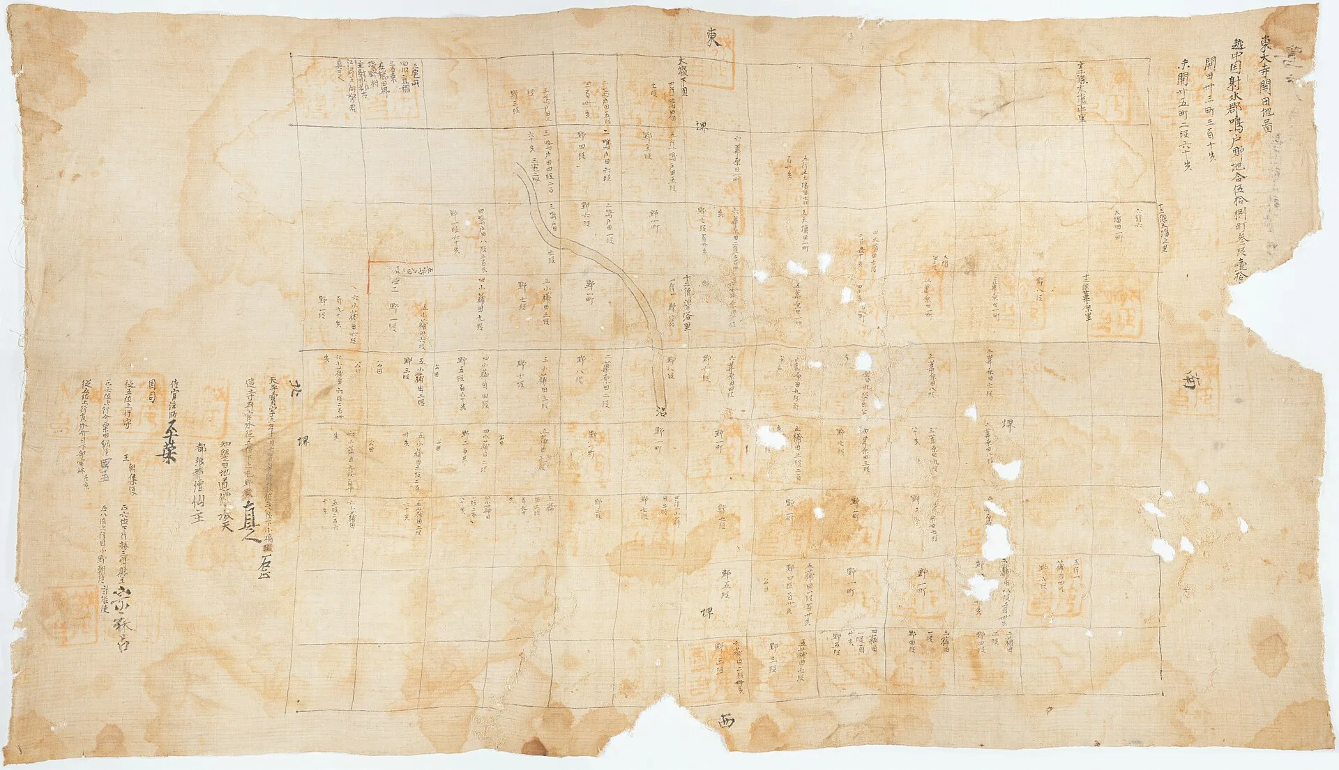
The map of reclaimed fields at Naruto village, Imizu district, Etchū Province, dated 759. Ink and light color on linen, 79.8 × 140.5 cm, formerly held by Tōdai-ji. The jōri grid and plot-by-plot land entries are visible, with the title “Tōdai-ji land development map: Naruto village, Imizu district, Etchū Province” at the upper right. Naruto corresponds roughly to central Takaoka today. Source: Wikimedia Commons
Settlements in the Toyama city area also kept developing. The Tōmi-Miyata site mentioned in the Asuka note (later 7th to early 10th century) remained in use through the Nara period, yielding about 810 ink-inscribed potsherds along with Buddhist objects such as begging bowls and miniature tile pagodas. The Toyama City Archaeological Center notes that in snowy, humid Hokuriku, heavy tile-roofed temples were rare — village chapels and tile pagodas were the more common form of local Buddhism15.
5. Kanazawa: Bohai Envoys and the Tōdai-ji Estate
Nara-period Kanazawa has no urban history, but the name “Kaga district” already appears in an international scene of the official history. The Shoku Nihongi records in the tenth month of 762 that when the Japanese envoy Iki no Masumaro returned from Bohai (Parhae), the Bohai ambassador Wang Xinfu and a party of 23 accompanied him, and they were “lodged and provisioned in Kaga district, Echizen Province”16.
Bohai was the northeast-Asian state that exchanged missions with Japan frequently from 727 onward; its envoys sailed the Japan Sea route, and the Hokuriku coast was the main landing and reception zone. The Matsubara guest house in Echizen and the Noto guest house were later institutionalizations of this line of exchange17. Note that the Shoku Nihongi records only that the party was “lodged and provisioned” there; it does not say where they landed. What it does establish is that Nara-period Kaga district lay on the Japan Sea exchange route and was an area that received Bohai envoys.
The archaeology supports this image of a waterborne node. At the Uneda-Nabeta site on the lagoon coast of western Kanazawa, excavations produced large quantities of ink-inscribed pottery centered on the character “east,” wooden tags recording rice varieties and marine product names, and stone belt fittings, and the site is considered administration-related; news reports speculated it was a hub of seaborne trade, though the storehouse remains date closer to the Heian period, so caution is needed when using it for the Nara period18.
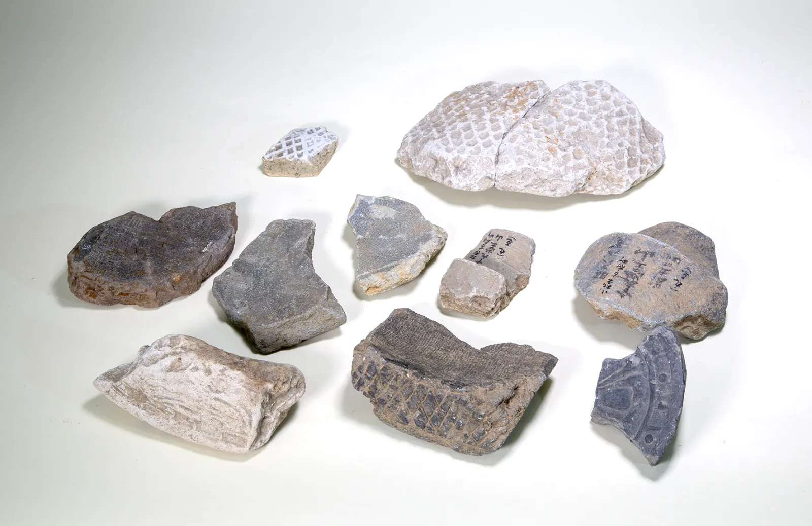
Kanazawa’s most important ancient site is the Tōdai-ji estate of Yokoe-no-shō. Ishikawa Prefecture explains that Yokoe-no-shō appears in the Tōdai-ji documents (kept in the Shōsō-in) as the bequest of Imperial Princess Asahara, daughter of Emperor Kanmu, donated to Tōdai-ji in 818, and that the site is an estate worked from the Nara into the Heian period19. The city of Kanazawa’s page on the Kami-Araya area is more concrete: excavations revealed the estate’s administrative office (shōka), workshops, a canal navigable by boats, and a landing; ink-inscribed pottery bears estate names such as “Tamiya,” “Aya-no-shō,” and “Higashi-no-shō,” and tag-shaped wooden tablets from the canal record goods with their origins and destinations. The 1,131 excavated objects are an Ishikawa Prefecture designated cultural property20.
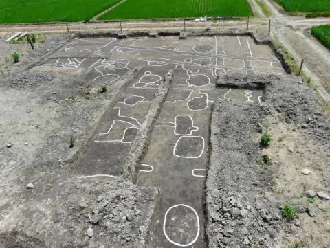
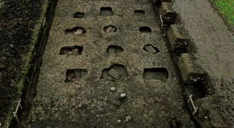
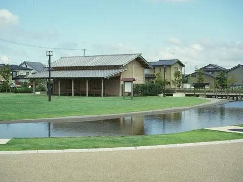
The Kami-Araya site (the Kami-Araya sector of the Yokoe-no-shō estate site), now maintained as a historic site park. Source: City of Kanazawa
One caveat on chronology: the 818 donation is already early Heian, and what Yokoe-no-shō shows is an early estate of the late Nara to early Heian transition. It belongs to the same context as the estate maps in section 4 — Tōdai-ji’s estate network extending into Hokuriku — but the written evidence on the Kanazawa end runs about half a century behind Etchū. Kanazawa’s “Ancient Village” heritage page adds that the Kami-Araya site yielded potsherds inscribed with characters such as “gold,” “naka,” and “path” — among the few ancient written materials in the city area21.
6. Komatsu: A Kiln Belt and the Hakusan Tradition
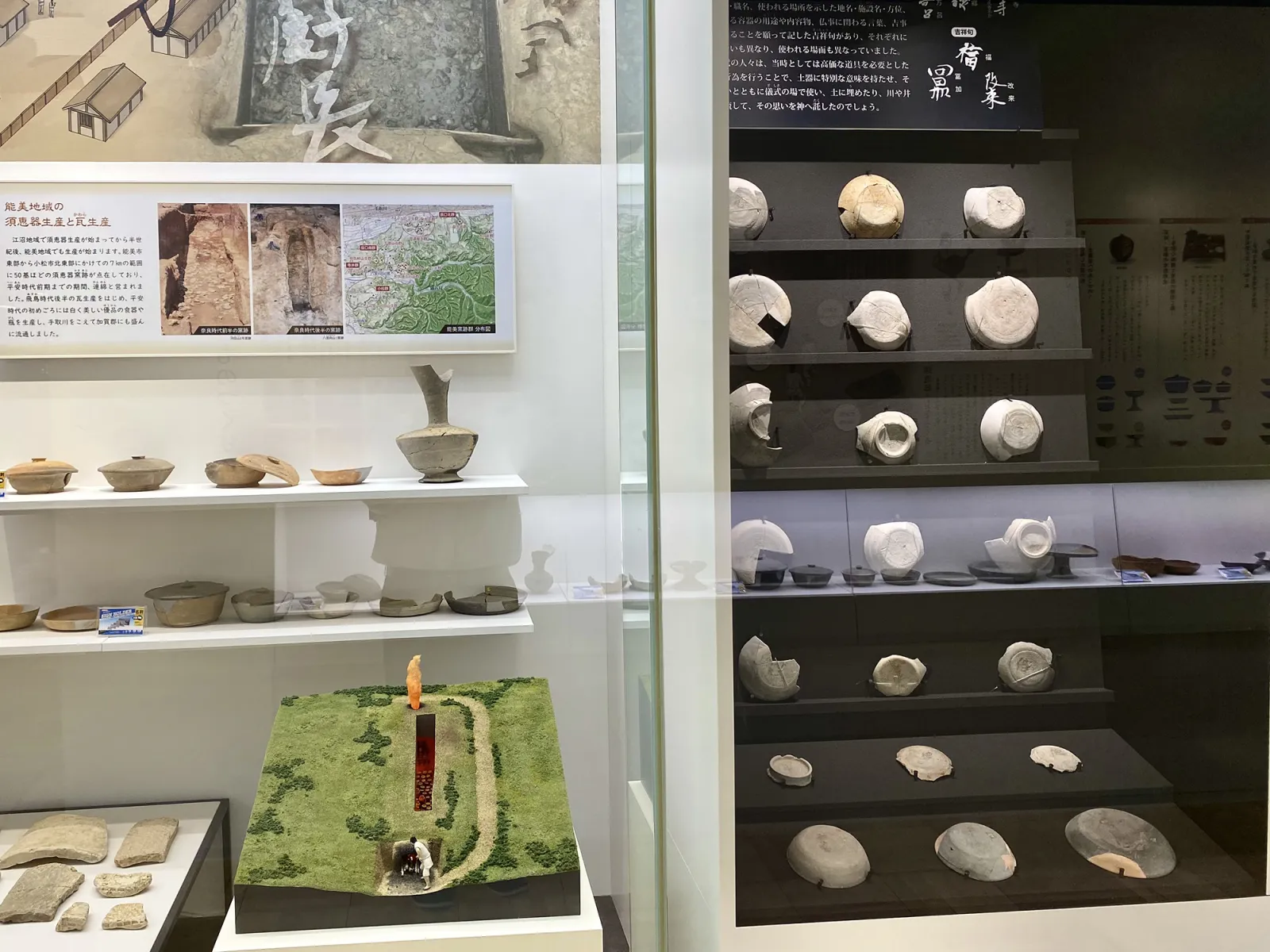
Komatsu’s Nara-period materials are mainly production sites. The city explains that the South Kaga ceramic production sites spread over the hills from Tozu and Hayashi to Nata in Komatsu and into Bunkyō and Matsuyama in Kaga City, with main periods spanning the Kofun, Asuka, Nara, and Heian eras; the kilns form 35 groups in 6 zones with more than 270 confirmed kiln remains, and Sue ware production continued almost unbroken for nearly 500 years from the mid-Kofun to the late Heian period — the largest ancient ceramics production area in Hokuriku22. Nara-period Komatsu was one stretch of this belt.
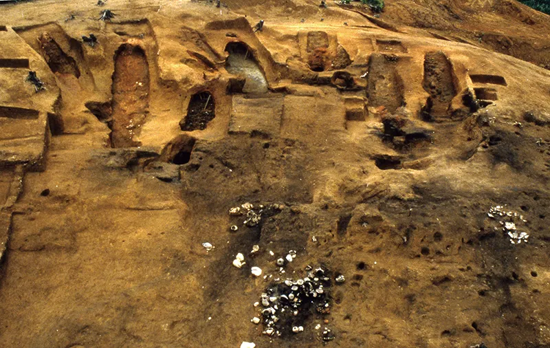
A Sue ware kiln of the Tozu kiln group. Source: City of Komatsu
On the side of belief, the main material is the tradition of Taichō and Hakusan. Shirayama Hime Jinja explains that Taichō climbed and “opened” Mount Haku in 71723; the chronology of Natadera likewise records that in 717, after Taichō’s ascent of Hakusan, he founded the temple’s predecessor Iwaya-dera in the autumn of the same year24. These are temple and shrine traditions, not contemporary sources, but they anchor the starting point of Hakusan worship firmly in the landscape around Komatsu — and when Bashō visited Natadera on the Oku no Hosomichi journey a thousand years later, he was calling at a sacred site on this same line of tradition24.
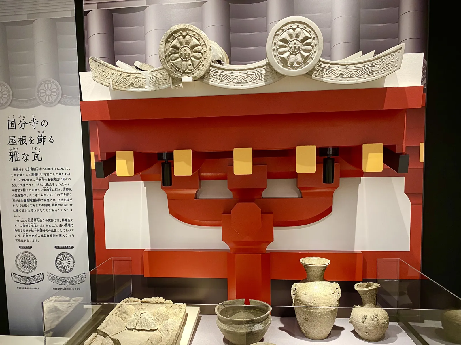
Finally, the doorway to the next era. After Kaga Province was established in 823, the leading candidate site for its capital is the area around Isobe Shrine in Kofu-machi, eastern Komatsu; the Kofu upland has produced many Heian-period vessels along with roof tiles thought to have adorned the Kaga Kokubunji1. Strictly speaking these are already Heian materials, but for a traveler they explain why the place name “Kokufu” (provincial capital) survives today in Komatsu rather than Kanazawa.
7. Why the Three Areas Look So Different
Side by side, the density of Nara-period written records runs roughly: Toyama (Etchū) high, Kanazawa middle, Komatsu low to middle. This gap should not be read as a ranking of cultural level.
Toyama has abundant records because it stood in an institutional position that generates them: an independent province with a capital, governors, and tax and transport networks — and, in addition, Ōtomo no Yakamochi served here for five years and wrote his experience of the place into the Man’yōshū11. Distance from Nara, if anything, made institutional activities like governors’ postings and goods transport more likely to be recorded.
Kanazawa and Komatsu were not inactive; their activity simply took forms that leave little literature or administrative writing. Kanazawa surfaces as estates, canals, wooden tablets, and ink-inscribed pottery20; Komatsu existed as a kiln belt22. Their textual visibility rises clearly only after 823, when Kaga Province gained its own capital and provincial temple — the subject of the next note.
8. Places You Can Visit Today
Most Nara-period sites have returned to farmland or streets; the places where the era can be felt on the ground cluster in Fushiki (Takaoka) and Kokufudai (Komatsu). The map below shows only facilities and spots that fit an itinerary.
| Area | Place | Type | Notes |
|---|---|---|---|
| Takaoka | Takaoka Man’yō Historical Museum | Museum | Dedicated to Yakamochi and the Etchū Man’yō; Fushiki-Ichinomiya 1-11-1125 |
| Takaoka | Shōkō-ji | Temple / historic site | National Treasure temple; the place name “Fushiki-Kokufu” and the provincial office monument preserve the capital’s memory10 |
| Takaoka | Etchū Kokubunji site (Yakushi-dō) | Historic site | Where the 741 provincial temple edict landed in Etchū; prefectural historic site12 |
| Takaoka | Keta Jinja | Shrine | By tradition founded in the Nara period; one of Etchū’s first shrines, near the presumed capital13 |
| Takaoka | Amaharashi coast | Scenery | Signature landscape of the Etchū Man’yō; the Tateyama range on clear days11 |
| Kanazawa | Kami-Araya historic site park | Historic site park | The Kami-Araya sector of the Yokoe-no-shō estate; where the canal and wooden tablets were found20 |
| Kanazawa | Ishikawa Prefectural Museum of History | Museum | Context for the ancient Kaga district and the 823 founding of Kaga Province |
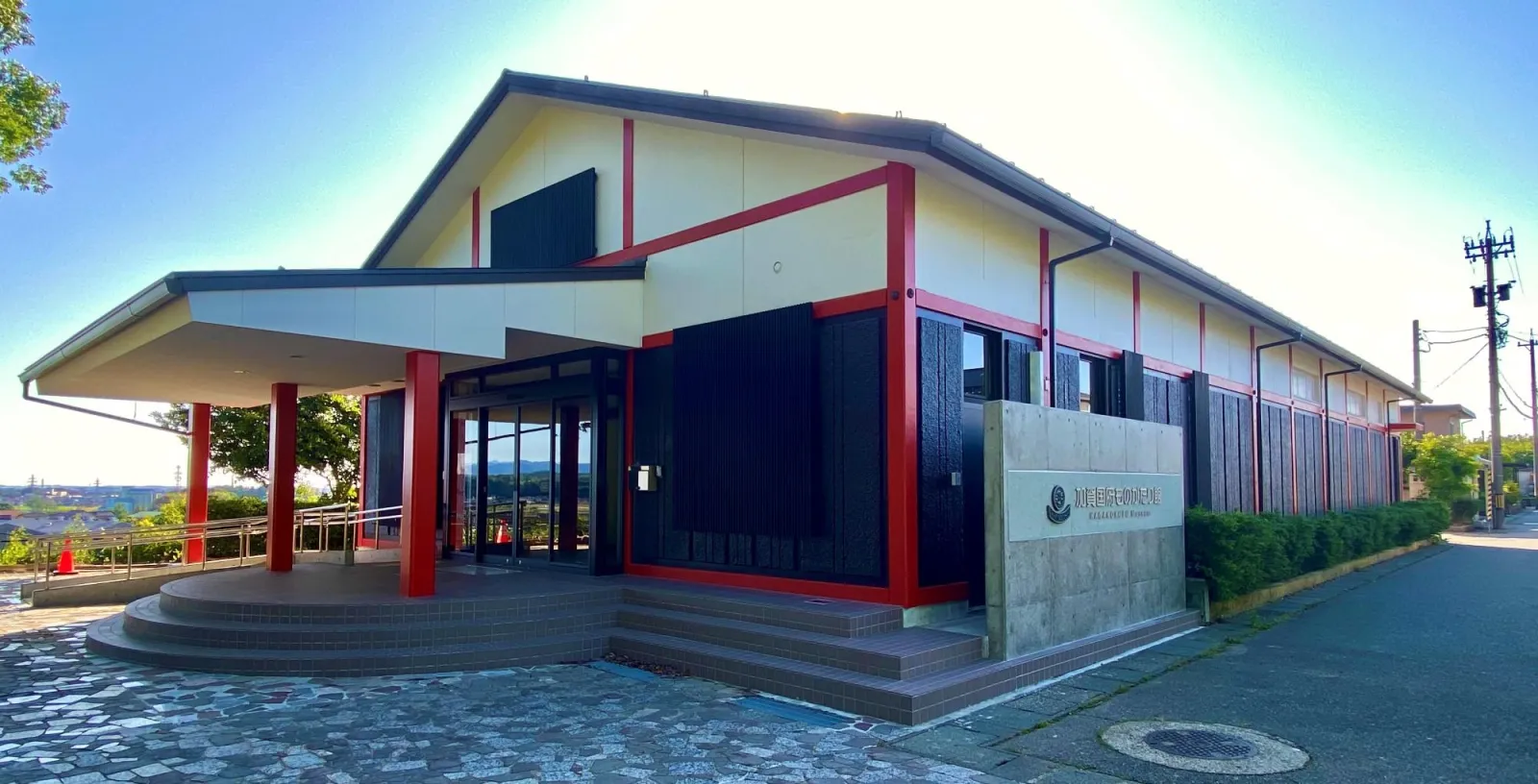
| Komatsu | Kaga Kokufu Monogatari-kan | Museum | Free; kiln reconstruction, ink inscriptions, and Kokubunji tile displays26 |
| Komatsu | Natadera | Temple | By temple tradition founded by Taichō in 717; Hakusan worship and Bashō’s visit24 |
References
Footnotes
-
City of Komatsu, “1200 Years of Kaga Province”: https://www.city.komatsu.lg.jp/soshiki/1052/kagarikkoku1200nensai_1/index.html ↩ ↩2 ↩3
-
Heijō Palace Site Historical Park, “What is Heijō-kyō?”: https://www.heijo-park.jp/about/heijokyo/ ↩ ↩2
-
Shoku Nihongi, vol. 2 (“Echizen” in the locust entry of 701; “epidemic in Echigo” in 702; “four districts of Etchū transferred to Echigo” in 702): https://zh.wikisource.org/wiki/%E7%BA%8C%E6%97%A5%E6%9C%AC%E7%B4%80/%E5%8D%B7%E7%AC%AC%E4%BA%8C ↩ ↩2 ↩3
-
The kokubunji system (Emperor Shōmu’s 741 edict): https://ja.wikipedia.org/wiki/%E5%9B%BD%E5%88%86%E5%AF%BA ↩
-
Cultural Heritage Online, “Tōdai-ji kaiden-zu”: https://online.bunka.go.jp/heritages/detail/170748 ↩ ↩2 ↩3
-
Shoku Nihongi, vol. 3 (706 entry adding nineteen shrines of Kai, Shinano, Etchū, Tajima, Tosa, and other provinces to the annual offerings): https://zh.wikisource.org/wiki/%E7%BA%8C%E6%97%A5%E6%9C%AC%E7%B4%80/%E5%8D%B7%E7%AC%AC%E4%B8%89 ↩
-
Shoku Nihongi, vol. 8 (719 entry: the governor of Echizen supervises Noto, Etchū, and Echigo): https://zh.wikisource.org/wiki/%E7%BA%8C%E6%97%A5%E6%9C%AC%E7%B4%80/%E5%8D%B7%E7%AC%AC%E5%85%AB ↩
-
Ishikawa Prefecture statistical materials, historical outline (Heisei 25 PDF): https://toukei.pref.ishikawa.lg.jp/dl/2623/h25j_all.pdf ↩
-
Etchū–Noto Man’yō Journey (Dragon Route Promotion Council), “On Etchū and Noto” (Noto merged into Etchū in 741, independent again in 757): https://www.dragonroute.net/dragon/manyou/etchunoto/etchunoto.html ↩
-
Takaoka Tourism Navi, “National Treasure Unryūzan Shōkō-ji”: http://www.takaoka.or.jp/viewpoint/detail_3209.html ; Shōkō-ji (grounds as the presumed Etchū capital site): https://ja.wikipedia.org/wiki/%E5%8B%9D%E8%88%88%E5%AF%BA ↩ ↩2
-
Takaoka Man’yō Historical Museum, “Ōtomo no Yakamochi and the Man’yōshū”: https://www.manreki.com/yakamochi/ ↩ ↩2 ↩3 ↩4 ↩5
-
Toyama Cultural Heritage, “Etchū Kokubunji site”: https://toyama-bunkaisan.jp/search/1685/ ↩ ↩2
-
Keta Jinja (tradition and Etchū ichinomiya): https://ja.wikipedia.org/wiki/%E6%B0%97%E5%A4%9A%E7%A5%9E%E7%A4%BE_(%E9%AB%98%E5%B2%A1%E5%B8%82) ↩ ↩2
-
Nara National Museum, “Map of official fields at Ishiawa village, Tonami district, Etchū Province (Tōdai-ji kaiden-zu)”: https://www.narahaku.go.jp/collection/894-1.html ; “Draft map of reclaimed fields at Naruto village, Imizu district, Etchū Province”: https://www.narahaku.go.jp/collection/894-3.html ↩
-
Toyama City Archaeological Center, “The history of Toyama City through archaeology: the ancient period”: https://www.city.toyama.toyama.jp/etc/maibun/center/rekishi/kodai/kodai.htm ↩
-
Shoku Nihongi, vol. 24 (tenth month of 762: Wang Xinfu and 23 others “lodged and provisioned in Kaga district, Echizen Province”): https://zh.wikisource.org/wiki/%E7%BA%8C%E6%97%A5%E6%9C%AC%E7%B4%80/%E5%8D%B7%E7%AC%AC%E5%BB%BF%E5%9B%9B ↩
-
Illustrated History of Fukui Prefecture, “Windows of Foreign Exchange (1)”: https://www.library-archives.pref.fukui.lg.jp/fukui/07/zusetsu/A12/A121.htm ↩
-
Comprehensive Database of Archaeological Site Reports, “Uneda-Nabeta site”: https://sitereports.nabunken.go.jp/ja/cultural-property/24905 ; Ishikawa Prefectural Library SHOSHO, “Heian-period storehouses in Kanazawa; wooden tags with marine product names; a hub of maritime trade? The Uneda-Nabeta site” (Hokkoku Shimbun, 2000-11-22): https://www.library.pref.ishikawa.lg.jp/shosho/detail/orgn/D000110741 ↩
-
Ishikawa Prefecture, “Tōdai-ji estate Yokoe-no-shō site”: https://www.pref.ishikawa.lg.jp/kyoiku/bunkazai/siseki/20161004.html ↩
-
City of Kanazawa, “(Nationally designated) Tōdai-ji estate Yokoe-no-shō site”: https://www4.city.kanazawa.lg.jp/soshikikarasagasu/bunkazaihogoka/gyomuannai/3/1/1/siteibunkazai/5/5816.html ↩ ↩2 ↩3
-
City of Kanazawa, “Kanazawa’s sites: the ancient village”: https://www4.city.kanazawa.lg.jp/soshikikarasagasu/bunkazaihogoka/gyomuannai/3/1/3/9166.html ↩
-
City of Komatsu, “South Kaga ceramic production sites”: https://www.city.komatsu.lg.jp/soshiki/1052/kokabetsurekishijiman/aw_k/mnm_pt.html ↩ ↩2
-
Shirayama Hime Jinja, “Hakusan worship”: https://www.shirayama.or.jp/about/hakusan-worship/ ↩
-
Natadera, “Chronology”: https://natadera.com/about/history/ ↩ ↩2 ↩3
-
Takaoka Man’yō Historical Museum, “Access”: https://www.manreki.com/access/ ↩
-
City of Komatsu, “Kaga Kokufu Monogatari-kan”: https://www.city.komatsu.lg.jp/soshiki/1052/2300.html ↩